
Page 9 - 1_KATALOG.cdr
P. 9
A WALK ON ZAGRLJAJ KAMENA I VJETRA TRAILA WALK ON ZAGRLJAJ KAMENA I VJETRA TRAILA WALK ON ZAGRLJAJ KAMENA I VJETRA TRAIL
EN
Track information:
Name: Zagrljaj kamena i vjetra
Length: shorter route 3 km (one way to HRT transmitter) or 8 km (one way to the
windmills, possible transfer on return)
Trail: linear
Base: macadam and asphalt
Difficulty: medium
Starting point: parking lot, V. Nazor Promenade
Final point: HRT transmitter on the top of Krišina (shorter route) or the wind mills
(longer trail)
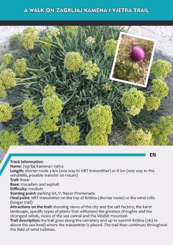
Attractions on the trail: stunning views of the city and the salt factory, the karst
landscape, specific types of plants that withstand the greatest droughts and the
strongest winds, views of the sea cannal and the Velebit mountain
Trail description: tre trail goes along the cemetery and up to summit Krišina (263 m
above the sea level) where the transmitter is placed. The trail then continues throughout
the field of wind turbines.